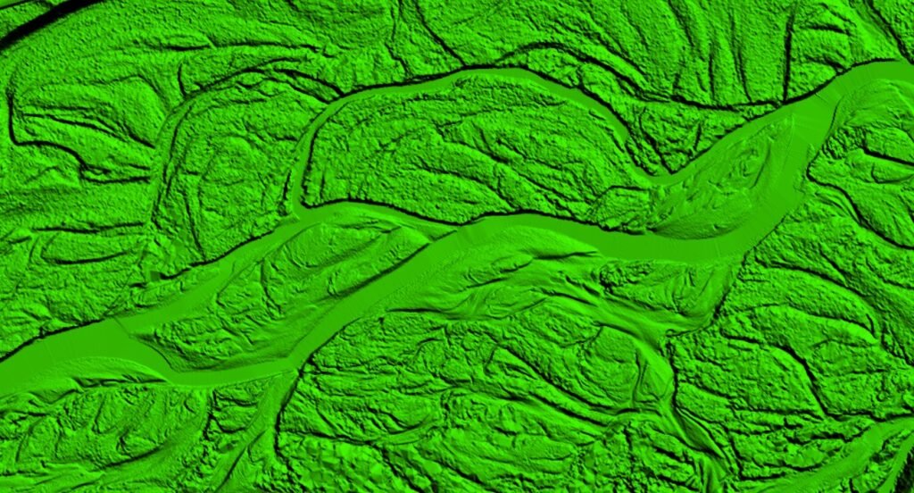
LIDAR

Processing LiDAR point clouds requires specialized software and expertise in remote sensing, GIS, and geospatial analysis. Vugol Geospatial continue to improve the efficiency and accuracy of LiDAR data processing, making it an invaluable tool for understanding to our global clients. The raw LiDAR data, in the form of point clouds, undergoes processing to filter out noise, classify different types of surfaces (ground, vegetation, buildings), and create a Digital Elevation Model (DEM) or Digital Surface Model (DSM).


PowerLine Classification

Vugol Geospatial LiDAR point clouds team have segmented thousands of linear km to identify potential powerline features based on their geometric characteristics. These includes the classifications of buildings, roads, powerlines, towers, distance measurements, catenaries etc


Advance Classification

Advanced Classification is a service provided by Vugol Geospatial that involves categorizing and analyzing complex geospatial data. This service uses sophisticated algorithms and machine learning techniques to classify various land cover types, vegetation, infrastructure, and other features from remote sensing data. By leveraging advanced classification, Vugol Geospatial helps clients in sectors like agriculture, forestry, urban planning, and environmental monitoring to make precise and data-driven decisions. This service enhances the accuracy of mapping and analysis, providing valuable insights for better resource management and planning.


Topo Mapping

Engineers use vugol's topo maps for site planning, grading, and infrastructure design. Our continuous evolvement with advancement in surveying technology and remote sensing, have enabled detailed and accurate representations of Earth's surface that are essential for various disciplines and applications.


Mobile Mapping

Mobile mapping systems play a crucial role in modern geospatial data collection, providing accurate and up-to-date information for a wide range of applications across various industries. Vugol's team have extracted thousands of features such as road edges, building facades, and tree canopies from point clouds for detailed analysis and modeling to the global standards.


DTM/DSM

Applications across various industries. Vugol's team have extracted thousands of features such as road edges, building facades, and tree canopies from point clouds for detailed analysis and modeling to the global standards.


Contour

Contour Mapping is a service provided by Vugol Geospatial that involves creating maps with contour lines to represent the elevation and shape of the terrain. These lines connect points of equal elevation, providing a clear visualization of landforms, slopes, and elevation changes. Contour mapping is crucial for land surveying, construction planning, environmental studies, and other geospatial applications. Vugol Geospatial uses advanced techniques to produce accurate contour maps, aiding clients in understanding the topography and making informed decisions for their projects.

Scroll to Top